Sea surface temperatures in the tropical Pacific have risen to record levels this fall, a sign that the current El Niño is continuing to strengthen. In the region where the phenomenon's trend is usually measured, waters are 6.1 degrees Fahrenheit warmer than normal.
NOAA said in its latest update that the phenomenon is strengthening, with a 90% chance of a very strong event this fall and winter and a 75% chance of a historic event stronger than any El Niño since 1950. According to its index data, this year's event represents the second-largest anomaly on record for July through September, even when the effect of global warming is excluded from the comparison.
“I feel that the term super El Niño is appropriate,” said Abby Frazier, a climatologist and geography professor at Clark University. Frazier said some areas are likely to suffer from drought, while others will be hit by extreme rainfall and flooding. She also urged communities to prepare immediately: some places may need water restrictions, while others should closely monitor rainfall forecasts.
UNICEF announced on Tuesday that its analysis shows hundreds of millions of children could be exposed to dangerous conditions because of the climate phenomenon, which increases the risk of heavy rainfall in some areas and drought in others. Executive Director Catherine Russell said more than 347 million children live in areas expected to become drier or wetter, adding that El Niño is expected to increase water shortages, malnutrition and disease outbreaks.
The University of Chicago's Climate Impacts Lab estimates that El Niño will raise global average temperatures enough to cause an additional 451,000 deaths from extreme heat worldwide. This estimate adds a human health dimension to a phenomenon usually discussed in terms of weather and climate disruption.
El Niño is a natural climate phenomenon that occurs when winds near the equator weaken and the upwelling of cold water to the surface of the eastern Pacific slows. The phenomenon usually raises global average temperatures, causes marine heat waves along the US West Coast and reduces activity during the Atlantic hurricane season.
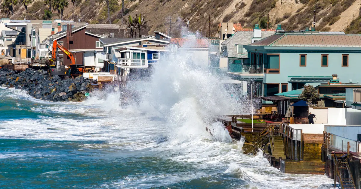
El Niño is also associated with heavy rainfall and storms in the southeastern US and warm conditions along the northwestern US coast, which can reduce snow and water supplies. Scientists expect the phenomenon to hit the US West Coast and cause unusual beach erosion, as storms send powerful waves toward shores where sea levels are already rising as warmer coastal waters expand.
El Niño's effect is most apparent in winter because it often shifts the normal flow of the jet stream, the high-altitude air current that circles the Northern Hemisphere and steers weather systems. The phenomenon usually pushes the jet stream south and disrupts the weather, which is why some areas may face drought while others experience flooding.
Frazier said the effects could spread through agricultural economies, affecting growing conditions for products such as rice, coffee and chocolate, and potentially changing supermarket prices through supply chains. Signs of El Niño are also becoming more visible: the US had a historically mild Atlantic hurricane season, while powerful hurricanes moved across the Pacific. Unusual marine species, including whale sharks, sea snakes and nesting sea turtles, were spotted off California. NASA satellites also found that seas near the equator had risen as the water warmed and expanded.

Comments