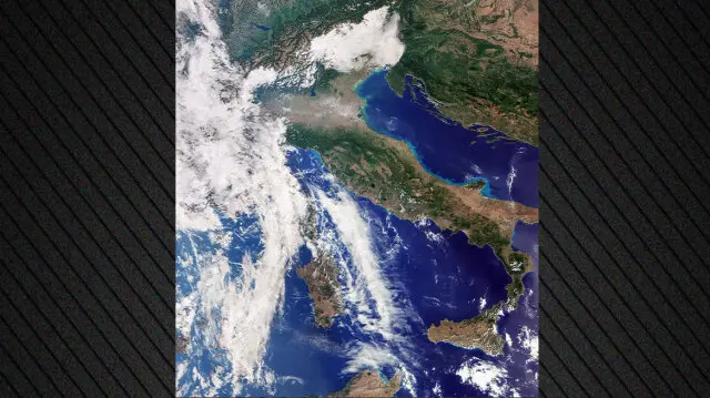
The Copernicus Sentinel-3C satellite sent the first images and measurements from two of its main instruments just two weeks after launch. According to the European Space Agency (ESA), these initial data confirm that it is operating normally to monitor the condition of the oceans, land and atmosphere.
The first images include areas of Italy, the Arctic and the Caribbean. The satellite also sent measurements of the height of Greenland's ice sheet and the sea surface.
Sentinel-3C is the third satellite in the Sentinel-3 Earth observation series and will continue supplying environmental data for a wide range of applications. Its observations are useful both for weather forecasting and for monitoring long-term changes related to climate change.
On land, its capabilities include monitoring drought and wildfires, mapping land use and assessing vegetation health. It also measures river and lake levels, as well as the height of polar ice sheets.
In the oceans, the satellite measures sea surface temperature, color and height. Its capabilities also include measuring sea ice thickness, complementing its observations of the polar regions.
Sending the first data marks an initial step, while preparation for full operational service continues. According to the report, ESA will need another five months to complete this complex process.




Comments