
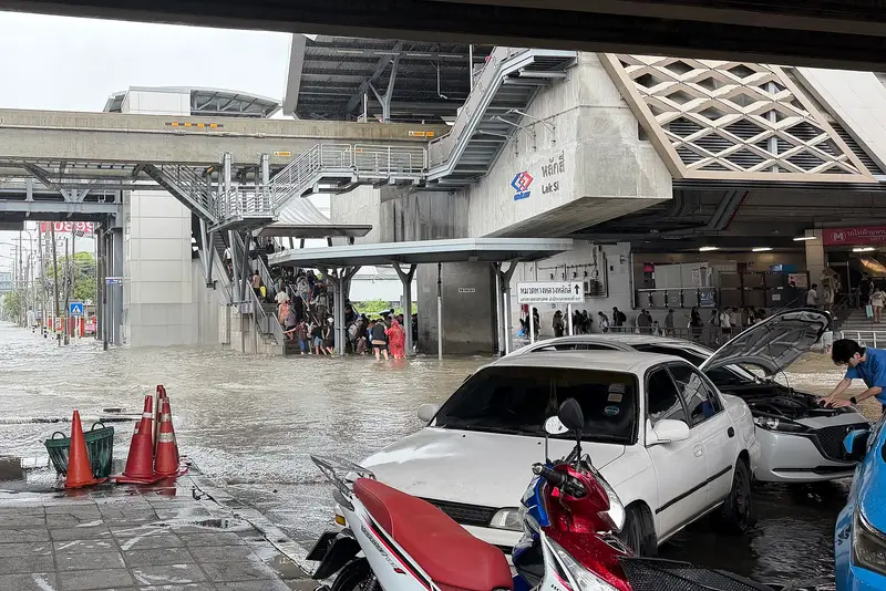
Bangkok was declared a disaster zone by municipal authorities towards the end of last week after streets in the Thai capital were covered by waist-deep water. The floods were caused by an active low-pressure cell over central Thailand, which brought continuous heavy rain and thunderstorms to Bangkok and the surrounding areas.
The heavy rain began early on Thursday, when the weak low-pressure area moved northwest over the Gulf of Thailand and then settled over central Thailand by Friday morning. For most of the following two days, the low pressure remained almost stationary, allowing relentless rainfall in and around Bangkok. A weather station near Prachin Buri, northeast of the capital, recorded 213.5 millimetres of rain in 24 hours between Friday and Saturday local time — by comparison, London receives an average of 585 millimetres a year. The centre of the system moved northwest on Sunday, bringing the torrential rain to an end.
In the central Pacific, Hurricane Nolo threatened Hawaii’s Big Island over the weekend. The system initially approached the archipelago early last week, bringing heavy rain from Tuesday evening. In the early hours of Saturday, Nolo was a category 2 hurricane with winds of 85–90 knots (98–104 miles per hour), and was at its closest point to the archipelago, about 145 miles (233 kilometres) south of the Big Island.
Strong winds were not the only threat: the enormous amount of rain raised concerns about flooding and mudslides. Since Nolo’s effects began late on Tuesday night, 22 September, stations in the northeast of the island have received more than 530 millimetres of rain.
Nolo moved west and away from Hawaii, with forecasts suggesting it would reach peak intensity on Monday, 28 September, possibly as a category 4 hurricane.
Farther east in the Pacific, Hurricane Polo is expected to reach the Baja California peninsula late on Monday, 28 September. Although it was once a category 5 hurricane, it will weaken to category 2 as it approaches, with winds of 96–110 miles per hour.
A hurricane warning has been issued for coastal areas because of the risk of a storm surge where winds blow towards the shore. Polo will also bring heavy rainfall as it crosses the peninsula, with 100–200 millimetres and locally up to 250 millimetres. Most of it will fall within 12 hours, increasing the risk of life-threatening floods and landslides.
The storm is expected to weaken as it moves northeast towards Mexico’s Sonora region.

Comments